| |
|
|
|
|
| |
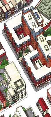
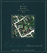
Beautifully
detailed and illustrated in three dimensions; Charleston
Illustrated is a 36"x 48" hand drawn, three-dimensional
map of downtown historic Charleston.
Rated  at
Amazon.com ! Read what our critics are saying:
at
Amazon.com ! Read what our critics are saying:
"For anyone who loves Charleston,
this map is a work that reveals her beauty through the details.
For anyone just getting to know the city, it will give you
insight to hidden treasures that even locals would normally
miss. The overall presentation of the map is first rate. I
strongly recommend this map to anyone who is visiting Charleston,
or to anyone who lives there and loves the city."
- Bruce Weddendorf, Huntsville AL, former Charlestonian
One of the world's most detailed
maps, it is the only map of Charleston
to portray every structure within its boundaries, uniquely
capturing the historic district’s architecture and charm.
|
|
|
|
| |
Charleston Illustrated took
over 14 months to produce. We collected all city, federal,
historic maps and aerial photos we could get our hands
on. Then we took over 5000 photographs of every single
building, street and park.
It also drew on years of
experiences from growing up in downtown Charleston;
of climbing (other people's) walls, playing in (other
people's) backyards; and exploring all of the city's
backlots and graveyards (mostly at night).
This map is an Axonometric
Projection (Plan Oblique)- which is a method of drawing
that has no vanishing points. This means that all of the
buildings are drawn at the same scale, 1 inch equals 200
feet. It is extremely accurate (except for one missing
magnolia tree somewhere downtown ;-).
This edition
includes: the Visitor Center, the Aquarium, Waterfront
Park, Ansonborough, the College of Charleston, Upper and
Lower King Street, the Market Area, the French Quarter,
the Battery and the historic areas south of Broad.
This 36”x 48”
full color poster-quality map not only includes every
building but also has over 150 listings and locations
for:
-
Historic
Landmarks and Churches
Museums and House Museums
Restaurants and Accommodations
Galleries, Antiques and Shopping
ATM’s, Public Restrooms and Parking
-
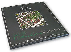
Charleston Illustrated is available
both folded in a beautiful protective sleeve or as a
poster suitable for framing.
Poster
Version
Charleston Illustrated is also available
as to rolled 36" x 48" poster, suitable for
framing. The poster can by ordered directly from us-
please email us.
Please note- as our email accounts
have been overwhelmed by junk email- please type
"charleston map" in the
subject of any message you send us. I apologize for
this, but it is the only way I can be sure that your
message is not accidentally filtered out by the email
software.-JM
|
|
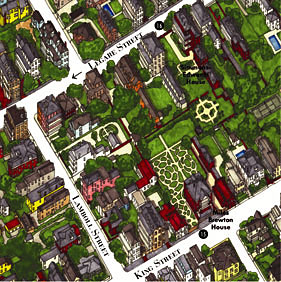
View
Details of Charleston Illustrated :
The
Battery
"The
Battery" loosely refers to the series of sidewalks
and railings that run along the tip of the city. It also
refers to the park, actually called "White point Gardens".
"High Battery" refers to the raised sidewalk that
run along East Battery Street.
South
of Broad
"South
of Broad" is the southernmost part of the peninsula
city where many of the grandest houses were built. Generally
considered to be the most exclusive of neighborhoods; although
those of us from that area don't believe in such things;-)
Four
Corners of Law
"The
Four Corners of Law" is the intersection of Broad &
Meeting Streets; where St. Michaels, City Hall, the County
and Federal Courthouses reside. It refers to city law, state
law, federal law, and God's law.
French
Quarter
Charleston's
"French Quarter" refers to the area around State
Street, where French Huguenots settled.
Now this district houses many of the city's art galleries.
College
of Charleston
The College of Charleston
campus includes several city blocks around the original
buildings and Cistern (the open green space).
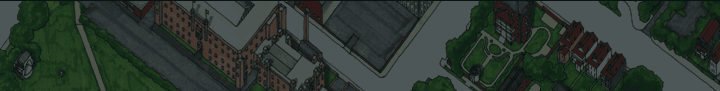
Full
Map
Full view of the entire
Charleston Illustrated map.
-
|
|
| |
|
|
|
|
|
To
Order:
Charleston
Illustrated is available as a folded map in sleeve (shown at left),
or an unfolded poster version rolled in a tube.
All orders shipped
by USPS Priority Mail. For orders, please email
us here.
-
|